See some guides below on finding inspiration and ideas to get outside. And if you’re ready to get going, check out OS Maps app and the Ordnance Survey website to discover local routes, plan your own adventures and find a range of tools to help you get the most of your time outside.

Whether you’re new to hillwalking, rambling or hiking and looking for some ideas and tips to get started, or a seasoned explorer hoping to broaden your horizons, OS Maps have everything you need to start your next adventure.
Accessibility
Explore our accessibility friendly resources below.

Stile-free walks
Whether you’re a wheelchair user, a family with a buggy or recovering from an injury, these accessible routes make it easier to enjoy the great outdoors. Here are the best stile-free walks in Britain.
Find out more")
Ramblers wellbeing walks – by Ramblers
Over 50,000 walks taking place all over the country to help improve the nations health and happiness. Here are some of the best Wellbeing Walks for you to join or try in your own time.
Find out more
How to get into cycling – by British Cycling
Whether you want to cycle more, rekindle your love for your bike or try it for the first time, British Cycling explain how you can get into cycling and get the most from your bike on a budget.
Find out moreMore useful articles...

Nations favourite places
Discover the nation’s favourites outdoor spots and visit somewhere new!
Find out more
Best short walks across Britain
Discover Britain’s 10 best short walks for a great day out. Featured in the OS Short Walks Made Easy guidebooks, each walk provides key information like where to park, where to eat and what to see on route.
Find out more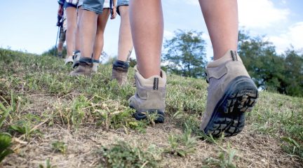
Outstanding circular walks
Discover Britain’s 10 best circular walks from the OS Pathfinder Guides. Each walk provides key information like where to park and what to see on route.
Find out more
Largest parks in Britain
Whether you seek nature, history, a place to play or just a moment of quiet, parks have something extraordinary to offer. Here are the top 100 largest parks in Britain.
Find out more

Walks for all types of weather
The Met Office team share their favourite walking and running routes across the UK and tells us how they differ across the seasons. Find walks for different weather conditions from the weather experts.
Find out more

Shaun the Sheep walks
Shaun the Sheep is the champion of Natural England’s Countryside Code. Shaun shares some of his favourite short walks suitable for the whole family.
Find out more

Hill walking safety for beginners
OS Champion Phillipa Cherryson spends a day with the Brecon Mountain Rescue Team for some pointers on hill walking safety for beginners.
Find out more")
Explore OS Guides
Find expert advice and inspiring articles to help you get outside more often. Filter guides by location and interest or search by keyword.
Find out more